


If you’ve ever reached a summit in the Lakes later than planned, you’ve probably wondered: am I too slow, or was my plan optimistic? UK trails swing from fast flagstoned paths to bogs, scree, and windy ridges — and with weather changing in minutes, your pace is rarely constant. Get it right and you finish in daylight; get it wrong and you’re racing the dark or missing the last bus.
This guide explains how fast you should be walking and how to estimate time realistically. We’ll start with Naismith’s Rule — still taught by the BMC and Mountaineering Scotland: allow 1 hour for every 3 miles (≈ 5 km), plus 1 minute for every 33 ft (≈ 10 m) of ascent. From there, we’ll show how terrain, ascent, weather, pack weight, and group dynamics affect real-world pace.
Most hikers average 2.5–3 mph (4–5 kph) on flat, easy paths, but many UK walks drop closer to 2.5 mph (4 kph) once ascent and faff are added. Strong winds, heavy rain, or winter snow can halve that speed.
What you’ll learn:
-
Core principles: Naismith’s Rule and modern adjustments.
-
Typical UK speeds by terrain (with tables).
-
Practical planning: OS Maps, ascent, transport, and daylight.
-
Weather & season: how conditions change pace.
-
Gear influences: footwear, poles, pack weight, layering.
-
Group vs. solo pace, families, and access code considerations.
Core Principles of Hiking Pace
Naismith’s Rule: The Classic Baseline
Most UK hikers first meet Naismith’s Rule in navigation courses or outdoor skills books. Devised by Scottish mountaineer William W. Naismith in 1892, it’s still the backbone of route-time planning today.
The rule states:
Allow 1 hour for every 3 miles (≈ 5 km) of horizontal distance, plus 1 minute for every 33 feet (≈ 10 m) of ascent.
That works out to an assumed 3 mph (4.8 kph) walking speed on flat ground — a pace many fit adults can sustain on good tracks. It’s simple enough to calculate on an Ordnance Survey map while planning your route, and it’s reliable enough that organisations like the BMC, Mountaineering Scotland, and the Ramblers still reference it.
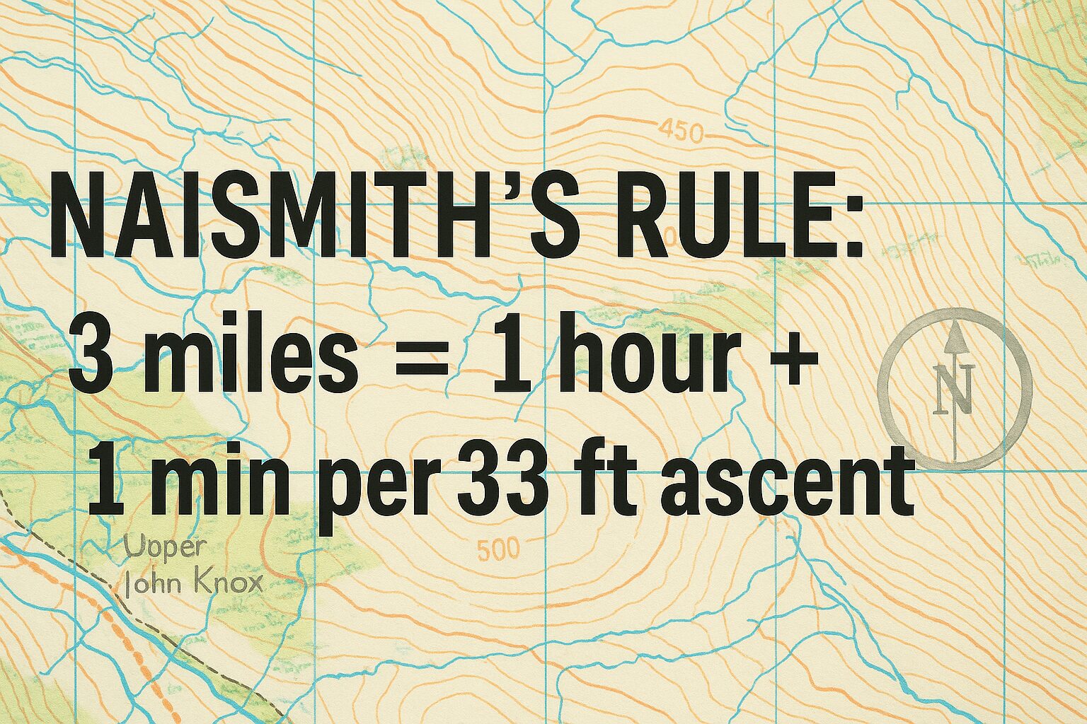
Naismith’s Rule: 3 miles equals 1 hour, plus 1 minute for every 33 feet of ascent.
Where Naismith’s Rule Helps
-
Planning day length: If your route is 12 miles (19 km) with 2,000 ft (610 m) of ascent, Naismith would estimate: 5 hours and 1 minute. (4hrs for the distance + 61mins to account for the ascents.)
-
Setting turnaround times: Good for knowing when you should realistically hit key checkpoints.
-
Group confidence: Gives beginners a baseline when they don’t yet know their personal pace.
Where It Falls Short
Of course, the Scottish hills — where Naismith walked — aren’t uniform. He assumed a steady, strong walker on moderate terrain. Today’s UK hiking throws in bog, scree, rocky steps, navigation faff, snack stops, weather delays, and group pacing. On many routes, the 3 mph (4.8 kph) base speed is optimistic.
Common Adjustments in the UK
Outdoor educators often teach refinements to Naismith’s simple model. The best known are:
1. Tranter’s Corrections (1950s)
Scottish mountaineer Philip Tranter suggested slowing the assumed speed for steeper ground:
-
On flat or gentle ground: 3 mph (4.8 kph)
-
On moderate ground: 2.5 mph (4 kph)
-
On steep/rough ground: 2 mph (3.2 kph)
This reflects what most of us find: a brisk flat pace quickly drops when you’re slogging up boulder-strewn paths in Snowdonia.
2. Langmuir’s Adjustments (1980s)
Eric Langmuir (author of Mountaincraft and Leadership) added refinements for descents and fatigue:
-
Subtract time when descending gentle slopes (you can speed up slightly).
-
Add time for steep or rough descents (knees, balance, and safety slow you down).
-
Factor in cumulative fatigue on long days, especially with heavy packs.
Example: Applying Naismith vs Adjusted Rules
| Route Example | Distance | Ascent | Naismith Estimate | With Tranter/Langmuir Adjustments |
|---|---|---|---|---|
| Malham Cove to Gordale Scar (Yorkshire Dales) | 4 miles (6.4 km) | 800 ft (244 m) | 1 hr 35 min | ~2 hrs (rocky steps slow pace) |
| Snowdon via Llanberis Path | 9 miles (14.5 km) | 3,200 ft (975 m) | ~5 hrs | 5.5–6 hrs (steep, crowded descent) |
| Kinder Scout Circuit (Peak District) | 8 miles (12.9 km) | 1,600 ft (488 m) | ~3.5 hrs | 4.5 hrs (boggy terrain adds time) |
Key Takeaway
Naismith’s Rule is a planning tool, not a stopwatch. Think of it as your starting point. Once you add terrain adjustments, weather, group size, and personal fitness, you’ll get much closer to the actual time it takes to complete a UK hill day.
Real-World UK Walking Speeds by Terrain
Even the best rules of thumb need grounding in reality. On the map, 3 mph (4.8 kph) might look fine — but the ground under your boots tells a different story. From manicured National Trust paths to boggy Pennine moor, here’s what typical walkers actually achieve in the UK.
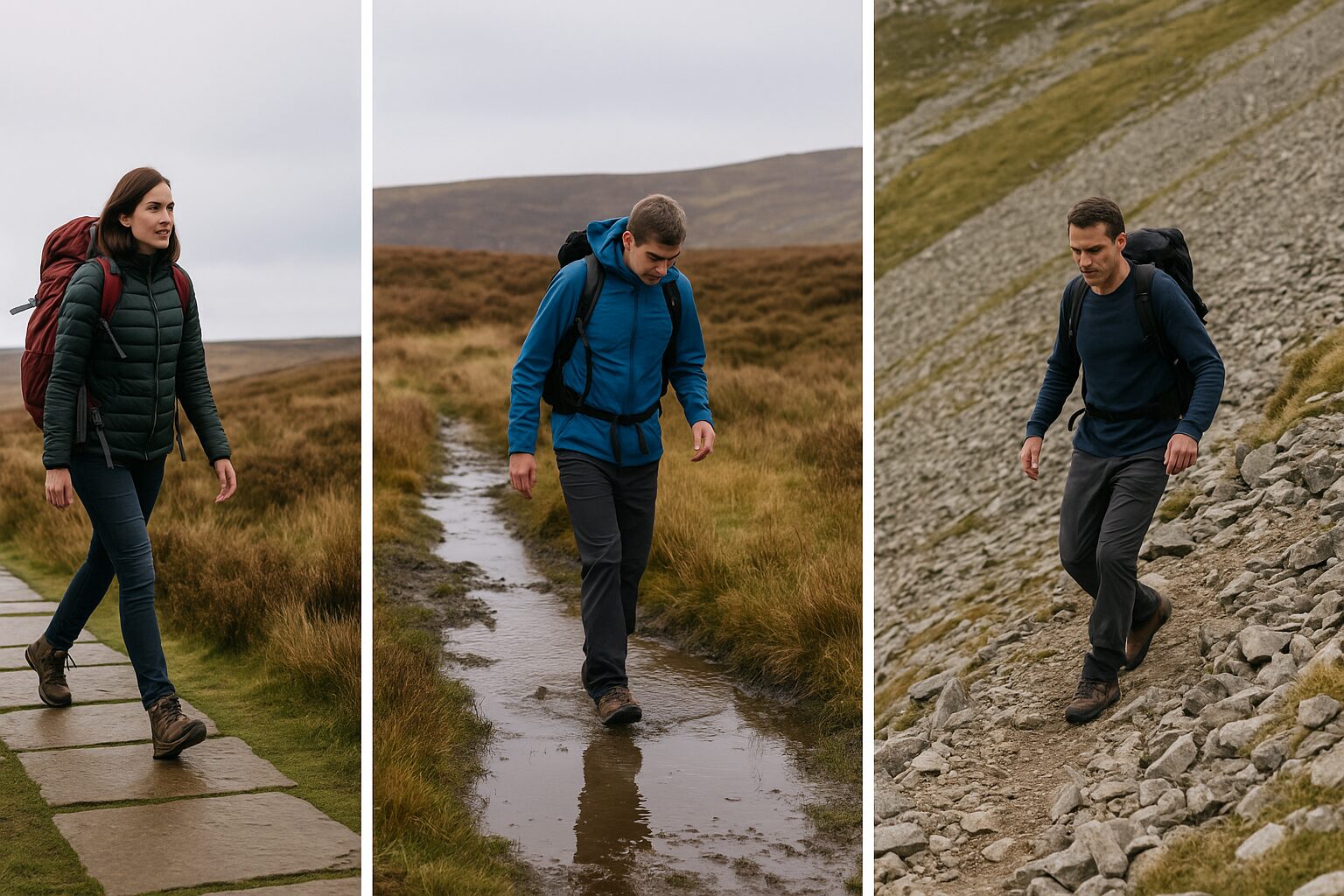
Britain’s landscapes shape your stride—greatly affecting your walking speed.
Average Walking Speeds on UK Terrain
| Terrain Type | Typical Speed (mph / kph) | Notes & Examples |
|---|---|---|
| Tarmac / Well-Made Gravel Track | 3–3.5 mph (4.8–5.6 kph) | Canal towpaths, forest tracks, estate roads. Ideal for fast progress. |
| Good Hill Path (Flagstones, Pitched Steps) | 2.5–3 mph (4–4.8 kph) | Seen on the Pennine Way, Snowdon Llanberis path, parts of the West Highland Way. |
| Grassy Fellside / Heather Moor | 2–2.5 mph (3.2–4 kph) | Common in the Lake District fells or Yorkshire Dales. Energy-sapping but manageable. |
| Bog / Peat Hag Country | 1.5–2 mph (2.4–3.2 kph) | Pennine Way, Cheviots, Flow Country. Expect slower if wet. |
| Rocky / Boulder-Strewn Terrain | 1–1.5 mph (1.6–2.4 kph) | Cairngorm plateau, Glyderau scree, Lake District boulder fields. Careful footwork slows pace. |
| Steep Ascent (Well-Made Path) | 1.5–2 mph (2.4–3.2 kph) | Ben Nevis Pony Track, Snowdon Pyg Track. Sustained uphill effort reduces speed. |
| Steep ascent (Rough Ground) | 1–1.5 mph (1.6–2.4 kph) | Direct routes in the Cuillin, pathless slopes in the Highlands. Short breaks often needed. |
| Steep Descent (Easy Path) | 2–2.5 mph (3.2–4 kph) | Easy angled descents, e.g. Glen Nevis. Quicker than uphill, but not flat speed. |
| Steep Descent (Loose / Rocky) | 1–2 mph (1.6–3.2 kph) | Skiddaw scree, Ben Lomond steps. Knees, balance, and safety reduce speed. |
| Coastal Paths (Rollercoaster Terrain) | 2–2.5 mph (3.2–4 kph) | South West Coast Path or Pembrokeshire Coast Path. Frequent ups and downs keep pace modest. |
What Affects These Numbers
-
Pack weight: A 20+ kg (44 lb) backpack can shave 0.5 mph (0.8 kph) off your average pace.
-
Weather: Wind, rain, or heat all slow you down. Gusts over 30–40 mph (48–64 kph) on ridges will cut pace dramatically.
-
Navigation: Frequent map checks in mist or tricky ground cost minutes per mile.
-
Group Size & Ability: A mixed-ability group travels at the pace of its slowest member. Families with children may average 1–1.5 mph (1.6–2.4 kph) over a full day.
-
Stops: A steady walker who rarely stops may finish earlier than a faster group who take long breaks.
Quick Comparison: Trail Examples
-
South Downs Way: Well-marked chalk track. Many walkers sustain 3 mph (4.8 kph) days.
-
West Highland Way: Mixture of easy estate tracks (3+ mph / 4.8+ kph) and boggy sections where speeds drop to 2 mph (3.2 kph). On some of the tougher sections along Loch Lomond, pace can drop below 1 mph.
-
Snowdon Horseshoe: Short in distance but technical; many walkers average 1.5 mph (2.4 kph) across the day.
💡 Planning Tip: Use Naismith’s Rule to get a baseline, then adjust using the table above. If half your route is on flagstoned path and half on bog, split your calculation accordingly rather than using a single speed for the whole day.
Practical Planning Guidance
Knowing your average walking speed is only half the battle. The real skill is turning those numbers into a realistic day plan you can actually enjoy — without rushing the last descent in the dark or missing the last bus home.
Using OS Maps to Estimate Time
Modern OS maps (Explorer & Landranger) make time planning straightforward:
-
Measure distance: Use the OS Maps app or a map tool to trace your route.
-
Calculate ascent: The contour lines tell you the total height gain. Add them up — 10 contour lines at 10 m each = 100 m (~330 ft).
-
Apply Naismith’s Rule: Start with 1 hour per 3 miles (≈ 5 km) plus 1 minute per 33 ft (≈ 10 m) of ascent.
-
Adjust by terrain: Refer to the terrain table — if half the route is bog, use 2 mph (3.2 kph) instead of 3 mph (4.8 kph).
💡 Tip: The OS Maps app has a “Route Timing” function that applies Naismith automatically — but you’ll still need to add real-world adjustments yourself.
Setting Turnaround Times
In the hills, a turnaround time is the point at which you commit to heading back or taking an easier exit — even if you haven’t reached your intended summit.
-
Check sunset time (Met Office or OS Maps app gives daylight hours).
-
Work backwards: if sunset is 6:00 pm, aim to finish by 5:00 pm.
-
Apply your estimated route time, then set a latest departure time.
👉 Example: A 7-mile (11 km) Lake District circuit with 2,000 ft (610 m) ascent. Naismith estimate = 3 hrs 40 min. Add terrain adjustments for rocky ground = 4.5 hrs. Sunset at 6 pm? Leave no later than 12:30 pm to build in safety margin.
Public Transport & Escape Routes
Many UK walkers rely on buses and trains:
-
Coast-to-Coast Path: Miss the bus in Kirkby Stephen and you may be waiting hours.
-
Snowdon: Llanberis buses finish earlier than you’d think outside peak season.
-
Highlands: Limited services can make being late more than an inconvenience.
Always check the last bus/train time and pad your plan with at least 30–60 minutes extra.
Factoring in Breaks
Walking speed isn’t the whole story — pauses add up.
-
10 minutes per hour for snacks/photos = an extra hour on a 6-hour day.
-
Lunch stops, kit adjustments, and faff, often add more time than you expect.
-
Rule of thumb: build in 25% extra to whatever Naismith/terrain maths give you.
Gear That Influences Pace
A few equipment choices can subtly shift your walking speed:
-
Footwear: Stiff boots slow you slightly on easy ground but help on rough terrain; lightweight shoes speed up easy tracks but can tire ankles on boulders.
-
Walking poles: Can add 0.2–0.5 mph (0.3–0.8 kph) on long ascents by saving leg energy.
-
Pack weight: A heavy 20 kg (44 lb) pack can shave 0.5 mph (0.8 kph) off your pace. Lightening your load keeps you closer to your flat-ground maximum.
-
Clothing: Overheating = more stops. Good layering reduces faff.
💡 UK retailer note: Stores like Cotswold Outdoor, Go Outdoors, Ellis Brigham, and Alpkit stock a wide range of poles, packs, and boots suitable for British hill conditions.
Example: Two Walkers, Same Route
-
Walker A: 9 miles (14.5 km), 2,500 ft (762 m) ascent, carrying 10 kg (22 lb) pack, good weather. Average 2.5 mph (4 kph). Finishes in ~5 hrs + breaks.
-
Walker B: Same route, 20 kg (44 lb) pack, wet ground, stronger winds. Average 2 mph (3.2 kph). Finishes in ~6 hrs + breaks.
Same legs — different outcomes. That’s why planning conservatively is the safest habit.
Weather & Seasonal Impacts on Hiking Pace
The British weather is a hiker’s best friend and worst enemy. It shapes not only your comfort but also your speed on the ground. Even the fittest walkers can find their pace slashed in poor conditions.

Compared to a Summers Day—Strong Winds, Heavy Rain, or Winter Snow can halve your walking speed.
Wind
The Met Office warns that winds above 30–40 mph (48–64 kph) can affect balance and safe movement on ridges. On exposed ground:
-
15–25 mph (24–40 kph): Noticeable resistance, slight drop in pace.
-
30–40 mph (48–64 kph): Walking into the wind can cut pace by 0.5–1 mph (0.8–1.6 kph). Side winds affect balance.
-
40+ mph (64+ kph): Hazardous on ridges; expect pace below 1.5 mph (2.4 kph) in exposed areas. Consider turning back.
Rain
Rain impacts pace less by physical resistance and more by ground conditions:
-
Light showers: Minimal effect on good tracks.
-
Persistent rain: Grass and rock become slippery; descents slow by 0.5 mph (0.8 kph).
-
Heavy rain: Boggy ground forms, paths flood, and route-finding slows. Expect 1.5–2 mph (2.4–3.2 kph) averages on rough moorland.
💡 Gear note: Gaiters and waterproof trousers help keep energy up by reducing faff when ground turns sodden.
Temperature & Heat
Though the UK isn’t famous for scorching summers, heatwaves are increasingly common.
-
Cool conditions (5–15°C): Ideal for pace; walkers sustain their normal average.
-
Warm (20–25°C): Sweat, dehydration, and overheating can cut speed by 0.5 mph (0.8 kph).
-
Hot (25°C+): Many walkers slow to 1.5–2 mph (2.4–3.2 kph). Shade stops and extra water are essential.
Winter & Snow
Winter changes the game entirely:
-
Icy paths: Even a dusting can slow pace by 0.5–1 mph (0.8–1.6 kph).
-
Deep snow: Speeds fall to 1 mph (1.6 kph) or less, especially off-path.
-
Technical ground (crampons/axe required): Progress may be as little as 0.5 mph (0.8 kph).
💡 Planning note: Shorter daylight hours in December and January (often under 8 hours in Scotland) mean time pressure is as limiting as terrain.
Fog & Low Cloud
Navigation faff eats into your day.
-
Add at least 10–20 minutes per hour if you expect thick fog or clag.
-
Mist can easily reduce pace by 0.5 mph (0.8 kph), especially if you’re pacing and taking bearings with a compass.
Seasonal Summary Table
| Condition | Typical Speed Impact | Example UK Scenario |
|---|---|---|
| Summer, dry trail | Normal pace (2.5–3 mph / 4–4.8 kph) | South Downs Way in July |
| Strong headwind (30–40 mph / 48–64 kph) | -0.5 to -1 mph (-0.8 to -1.6 kph) | Helvellyn ridge in winter storms |
| Heavy rain | -0.5 mph (-0.8 kph) on descents | Peak District gritstone escarpments |
| Hot weather (25°C+) | -1 mph (-1.6 kph) | Exmoor coast path in August |
| Icy/snowy path | -0.5 to -2 mph (-0.8 to -3.2 kph) | Cairngorm plateau in January |
| Deep bog after rain | 1.5–2 mph (2.4–3.2 kph) average | Pennine Way moorland |
Key Takeaway
Weather can reduce your pace by 25–50%, sometimes more. When planning, always build a buffer: if Naismith says 6 hours, and conditions are poor, expect 8. Better to finish early than stumble off the fell in the dark.
Group Dynamics & Special Situations
When hiking alone, your pace is yours to set. Add other people — children, beginners, or mixed-ability groups — and suddenly your carefully calculated 3 mph (4.8 kph) average is out the window. Understanding group dynamics is just as important as knowing Naismith’s Rule.

A group of hikers waiting at a stile in the Peak District contrasted with a solo hiker striding along a clear path.
The “Slowest Member Sets the Pace”
It sounds obvious, but it’s often ignored. A group only moves as fast as its slowest walker:
-
A mixed-ability party on the South West Coast Path might average 2 mph (3.2 kph) even if the fittest could manage 3 mph (4.8 kph).
-
Pushing weaker walkers too hard leads to fatigue, injuries, and morale problems.
-
Good leaders plan for the slowest, not the fastest.
Families & Children
-
Young kids (under 10): Often sustain 1–1.5 mph (1.6–2.4 kph) on hill paths. Flat routes may be slightly quicker, but expect frequent snack stops.
-
Teenagers: Similar to adults if motivated, but they can tire quickly with heavy packs.
-
Planning tip: Keep days short — under 6 miles (≈ 10 km) is plenty for younger kids in hilly terrain.
See also Hiking with Children – 11 Things Every Parents Should Know.
Large Groups
Walking in a group of 8–12+ slows things down:
-
Bottlenecks form at stiles, gates, scrambly steps.
-
Communication lags: Passing messages back along a group takes time.
-
Consensus breaks: Decisions (stop? push on?) take longer with more voices.
Result: large parties may average 0.5 mph (0.8 kph) slower than small groups, even on easy ground.

Often some are ready to continue, however the group as a whole (still taking a break here) set the pace.
Solo Hiking
Solo walkers often travel slightly faster:
-
Fewer breaks, no waiting at stiles.
-
Easier to sustain a personal rhythm — e.g. steady 2.5–3 mph (4–4.8 kph) on good paths.
-
But: solo travel requires more caution. You can’t rely on group support in emergencies, so conservative planning (extra buffer time, more kit) is essential.
Guided Groups & Charity Challenges
Events like the Yorkshire Three Peaks Challenge or National Three Peaks push pace hard:
-
Target times (e.g. under 12 hrs for Yorkshire Three Peaks) demand averages above 3 mph (4.8 kph) including breaks.
-
This is achievable for fit, prepared walkers — but exhausting for newcomers.
-
Training beforehand is essential, especially if you’re not used to long back-to-back hill days.
Accessibility & Inclusivity
-
Hikers with reduced mobility or using adapted equipment may have much lower average speeds, but pace isn’t the point — enjoyment is.
-
Many National Parks (e.g. Peak District, Lake District) now promote accessible routes on solid surfaces where 1–2 mph (1.6–3.2 kph) is more realistic and inclusive.
A Note on Codes of Conduct
Both The Countryside Code (England & Wales) and the Scottish Outdoor Access Code stress respect for others, safety, and planning ahead. This includes:
-
Allowing extra time: Don’t overestimate your group’s pace; it reduces pressure on livestock, landowners, and rescue services.
-
Turning back: If weather or fatigue slows the group beyond plan, retreating early is always the wiser option.
Key Takeaway
Group dynamics can reduce pace by 25–50% compared to solo walking. Plan with the least experienced or least fitmember in mind, and be generous with time estimates. A relaxed, achievable day beats a rushed, stressful one every time.
Final Thoughts & Key Takeaways
Hiking pace isn’t about racing. It’s about knowing yourself, your group, and the terrain under your boots. By combining Naismith’s Rule, terrain-based adjustments, and a healthy respect for Britain’s famously changeable weather, you can plan days that feel achievable — not punishing.
Key Takeaways
-
Baseline speed: On flat, easy paths most hikers average 2.5–3 mph (4–4.8 kph).
-
Ascent slows you: Add 1 minute per 33 ft (10 m) of climb to your timings.
-
Terrain matters: Expect 2 mph (3.2 kph) on moorland or coastal rollercoasters, and as little as 1 mph (1.6 kph) in bog, scree, or winter snow.
-
Weather is decisive: Strong winds, heavy rain, or icy ground can cut your speed by 25–50%.
-
Groups go slower: Families with kids or large parties average closer to 1–2 mph (1.6–3.2 kph).
-
Plan conservatively: Always add time for breaks, faff, and navigation. Finishing early is a bonus — rushing in failing light is not.
-
Respect the codes: The Countryside Code and Scottish Outdoor Access Code remind us to plan safely and responsibly.
A Personal Note
💬 On our first West Highland Way attempt, I planned a “short” 12-mile (19 km) stage that looked like 4–5 hours on paper. But after steady drizzle turned the path into a mud bath, our pace slowed to under 2 mph (3.2 kph). We arrived at camp nearly 7 hours later — tired but very aware that my “optimistic” timing could easily have left us short of daylight. That experience still shapes how I plan every UK “hill-day” today: always plan for less speed, not more.
— SQ
Final Encouragement
Hiking is about enjoyment, don’t obsess over numbers! Pacing is a tool to keep you safe, not a stopwatch to chase. Whether you’re tackling the Yorkshire Three Peaks, enjoying a family stroll along the Wales Coast Way, or testing yourself on the Snowdon Horseshoe, the goal is to finish with energy left, not crawl home exhausted.
If you learn your own rhythm, respect the weather, and build in generous margins, your hiking pace will always be “right” — for you.


